Taghmaconnell has an area of 76.2 km² / 18,827.4 acres / 29.4 square miles.
Townlands are unique to Ireland where they are the smallest units of land used for administration. Apart from a very small number in Scotland there are no such units in Britain.
The term “townland” in English is derived from the Old English word tun, denoting an enclosure. Originally townland might have represented the house and farm of the individual Gaelic landowner.
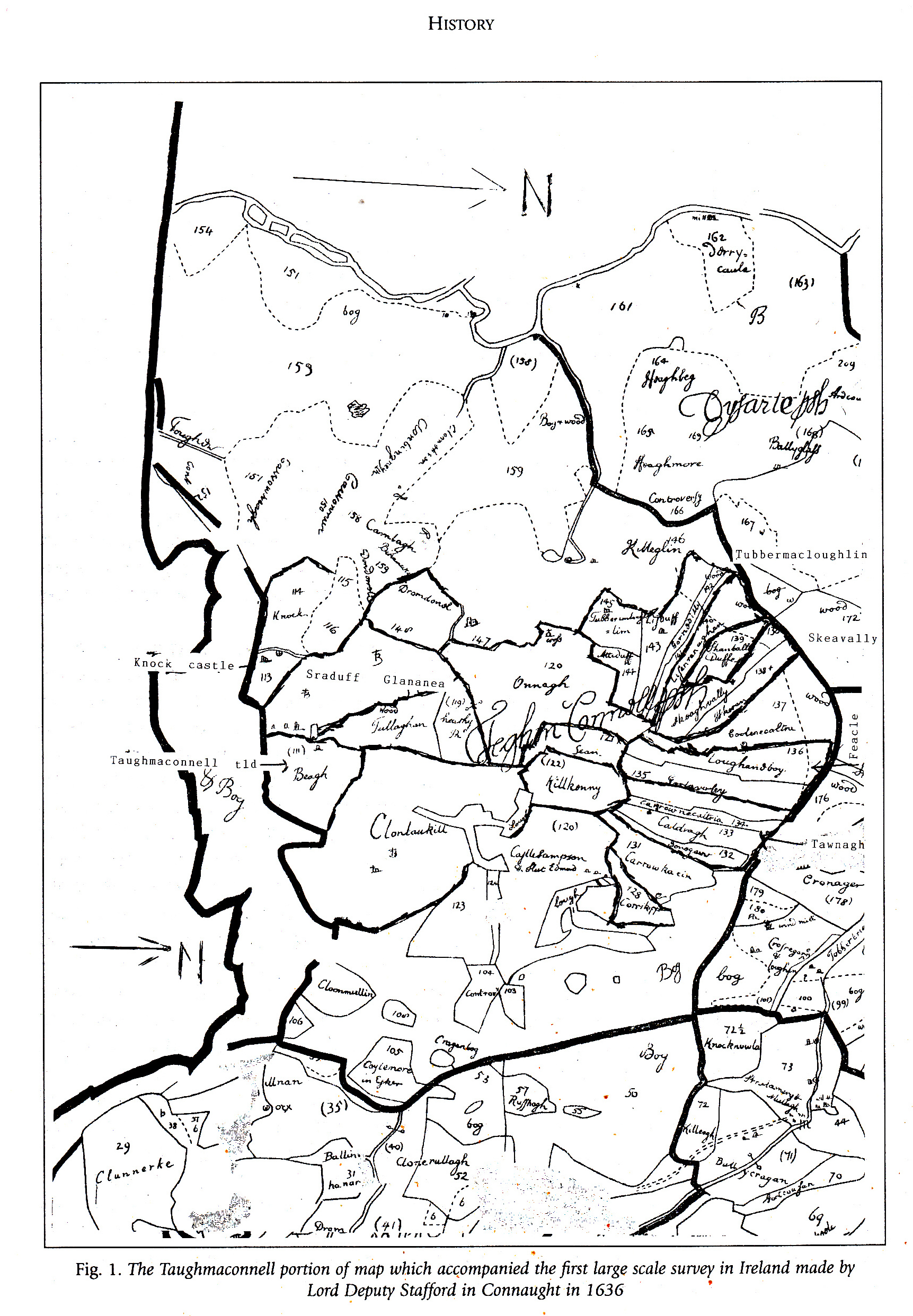
The concept of townlands is based on the Gaelic system of land division, and the first official evidence of the existence of this Gaelic land division system can be found in church records from before the 12th century, it was in the 1600s that they began to be mapped and defined by the English administration for the purpose of confiscating land and apportioning it to English investors or planters.
More information on townland’s can be found at https://www.townlands.ie/, it says that there are 42 townlands that in Taughmaconnell.
The first large scale survey of Ireland was made by Lord Deputy Stafford in Connaught in 1636. This is shown as the background to this page.
The present townlands were given their boundaries and names in the Ordnance Survey of 1837. These are shown below, and a full list is available at https://www.townlands.ie/roscommon/taghmaconnell2/


